
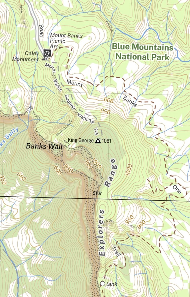
Distance: 15km
Time: 6 hrs
28/12/2025
It was a surprisingly cool day for the end of December with almost no wind. I knew I would want good conditions if I was going to complete the full loop. The Traverse of the Gods is a “walkable” route across the middle ledge of Banks Wall, typically done east-west. It utilises old climbers tracks, some used since the 1960s, passing huge caves and suspended rainforests.
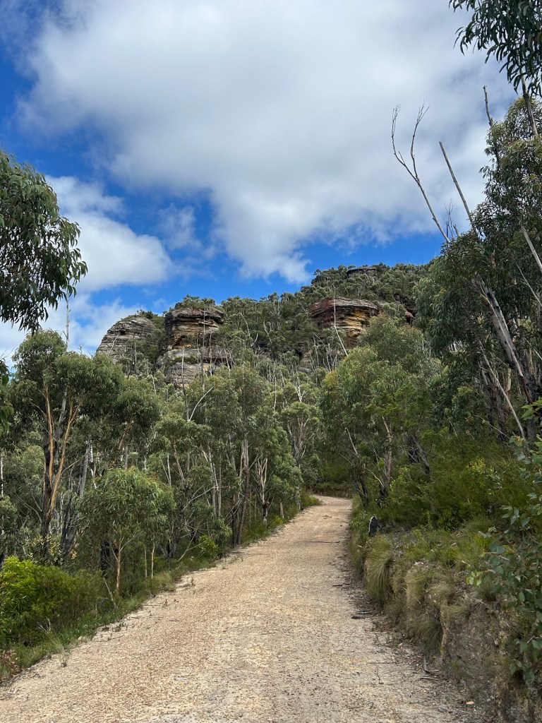
Roughly 9:45 I was out of the car and on the fire trail that wraps around the north eastern side of Mount Banks. There were a few small groups preparing in the car park but most people were taking the (rather monotonous in my opinion) summit trail straight up the mountain. This made for good wildlife spotting along the fire trail, a couple of king parrots and heaps of lizards.
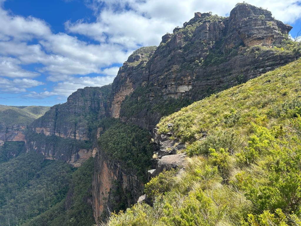
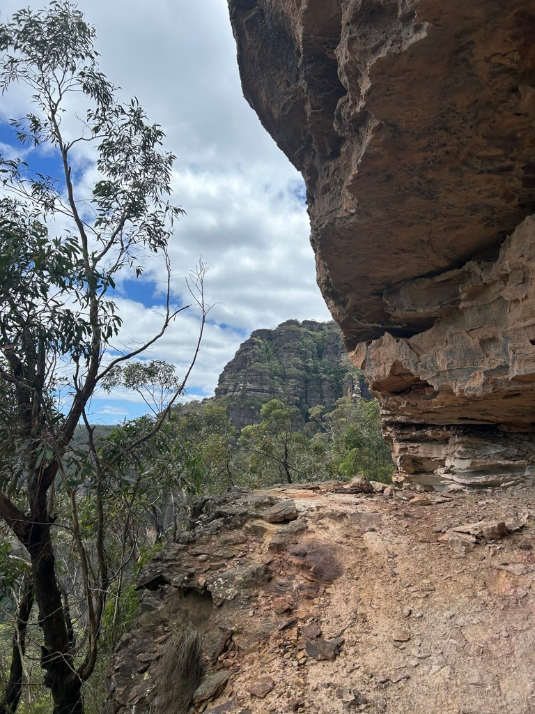
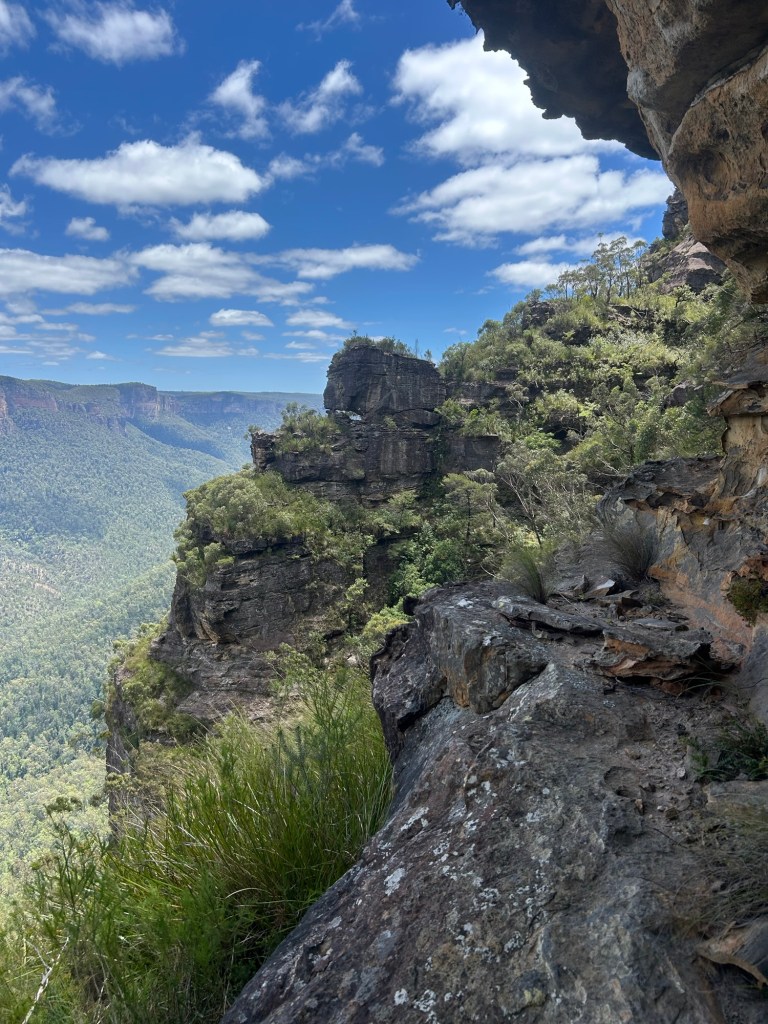
Once you meet the cliff line again on the eastern side of Mount Banks you can take in the rugged beauty of the Grose Valley. You also get a good view of the route ahead which at points seems completely impassable.
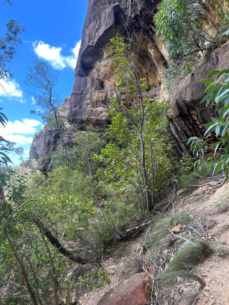
I head off the trail towards the cliff line and negotiate a small drop on to a ledge a couple of metres below the ridge itself. After a few minutes of passing what looked like slightly easier ways down I picked up a rough foot pad and the true journey had begun.
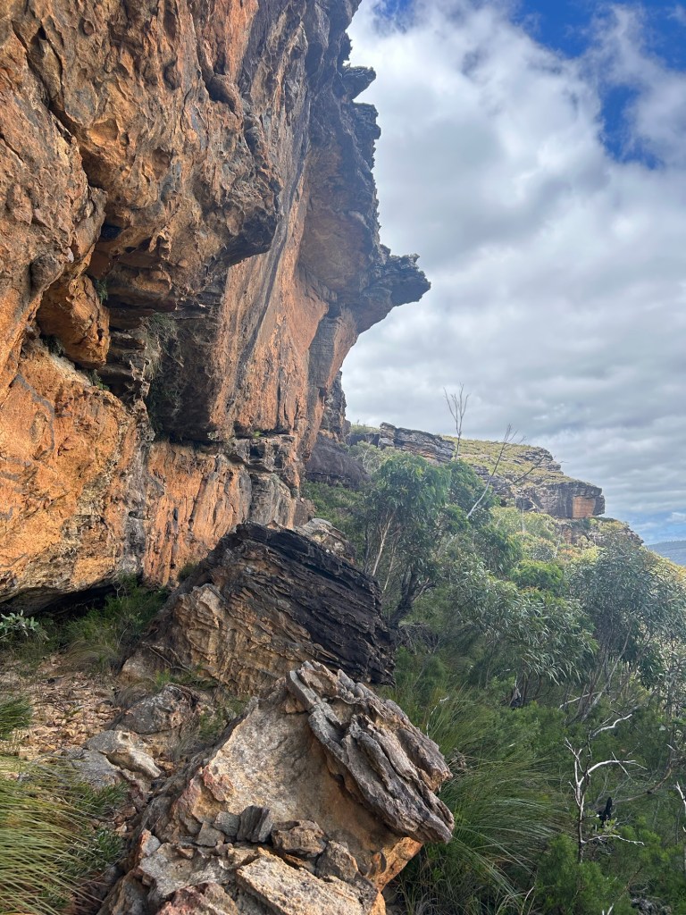
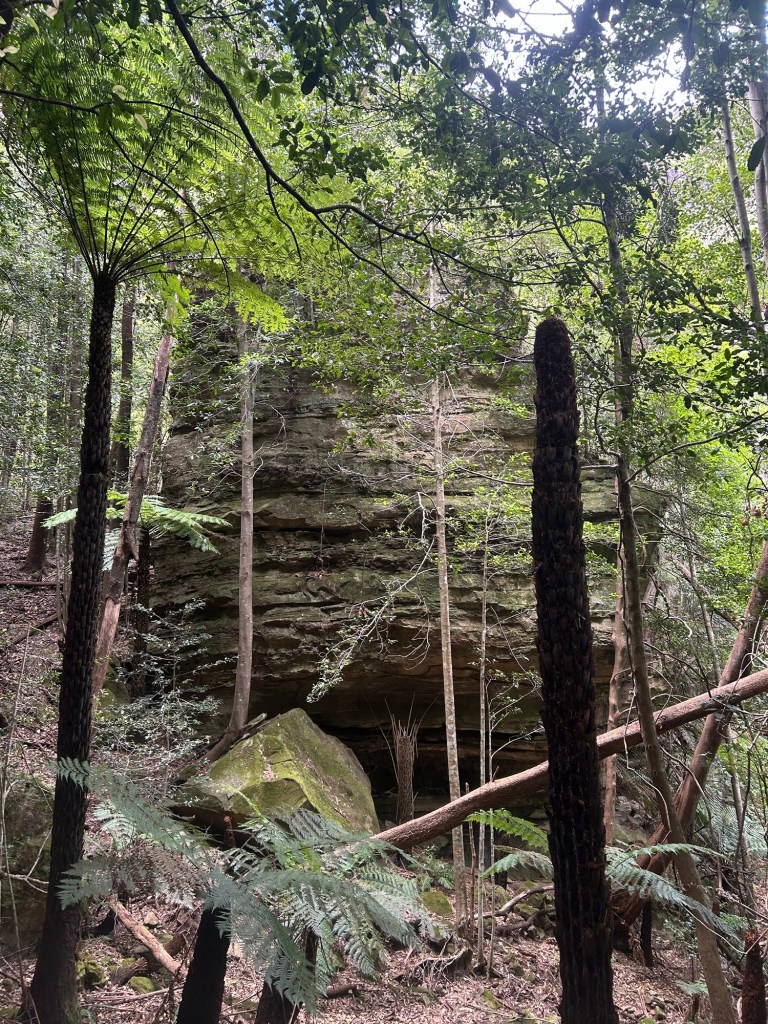
This part of the walk is actually quiet easy, just some loose crumbly rocks and a bit of scrambling . The thick heath can mostly be avoided by sticking to the walls on the right. Many cool rock overhangs and caves as well as constant views down into the valley below, a reminder of the seriousness of this terrain.
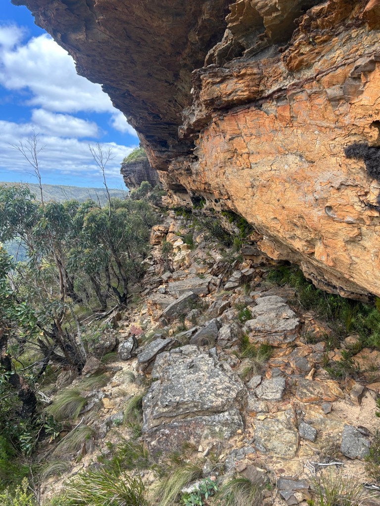
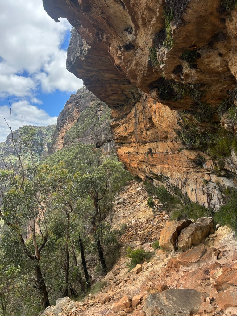
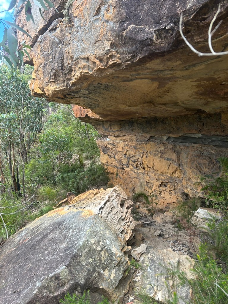
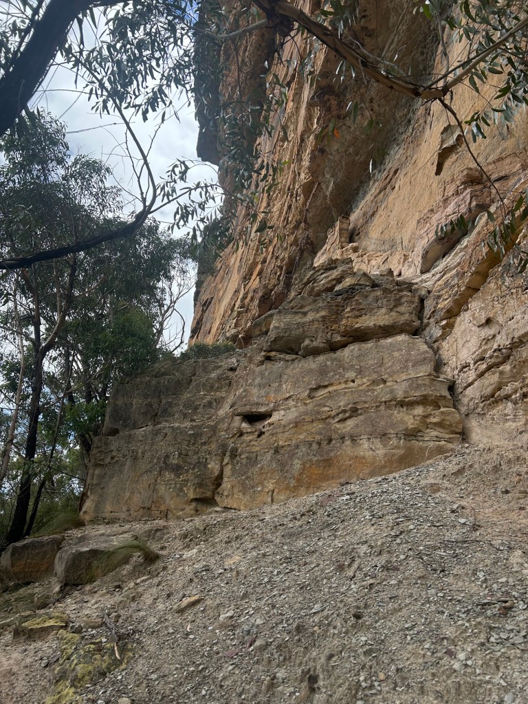
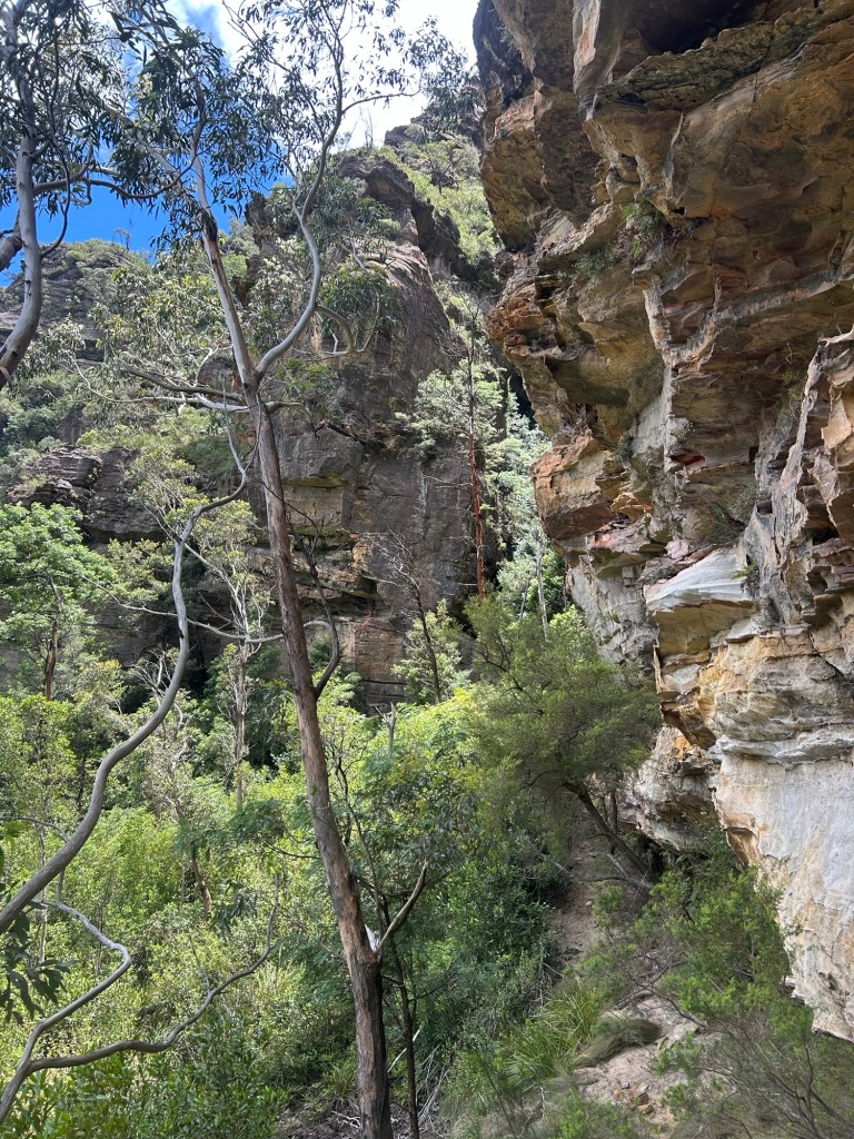
By this point the walls are looming high above me and the distance between them and the cliff line gets gradually smaller but nothing exposed yet. From my prior research the navigational challenge was obviously not directional (cliff left, wall right) but rather finding the right height and not accidentally shooting too high or low into more dangerous terrain. This is exactly what ended up happening.
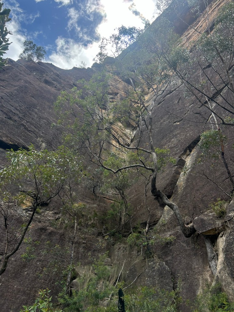
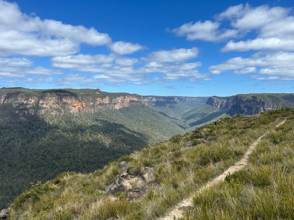
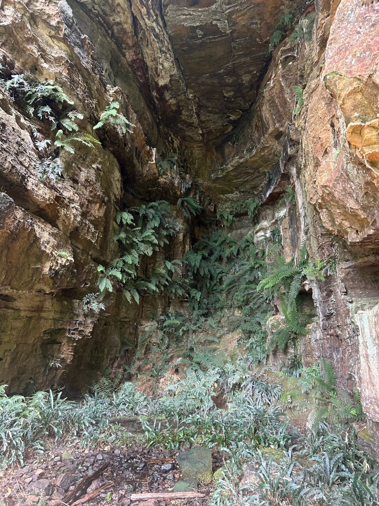
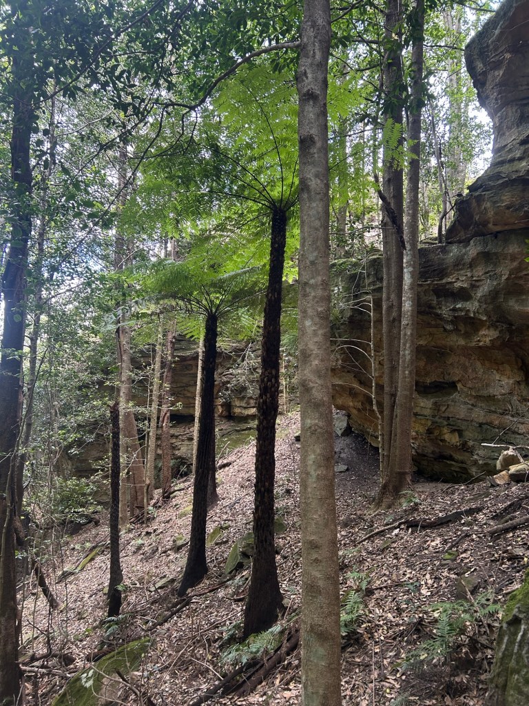
After about 1.5km the ledge drops slightly in altitude and opens up on to a shelf where a rainforest sits suspended hundreds of metres above the valley floor. This sudden change of scenery is an interesting showcase of the Blueies unique geology. Roughly 15-18 million years ago (Miocene period) volcanoes in northern NSW were spewing huge lava flows out and across the country. Mount Banks and a few other prominent sandstone peaks in the area were covered and left with hard basalt caps. The rich soil encourages thick dry scrub to dominate the tops of these mountains. Further down, this rainforest surviving clinging to the edge of a cliff is only possible due to the extremely porous sandstone it sits and soaks up.
The temperature drops, canopies above block out the sun, and I am surrounded by some of the biggest ferns I have ever seen. It is like entering another world.
I stopped for some lunch in the shaded canopy by a gorgeous ferny amphitheatre.
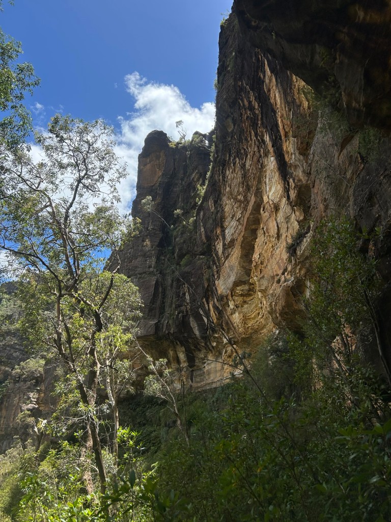
Now this next part is where taking your time to find the right route is important. Right around the corner from this forested section is a gully that juts hard back into the mountain known as the ‘Devils Throat’. After a little more research on other blogs and track notes now that I’m home, it seems I may have ended up slightly lower than I was meant to be. This resulted in some pretty hairy moves to get back up and out of the gully from the other side. In retrospect it may have been wiser to turn around and find a less exposed way across but I can’t pass up a good challenge. Nothing too technical but very exposed.
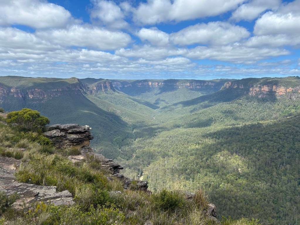
After a couple of short climbs up and back on to what was almost certainly the right level it was all pretty smooth sailing across heathy grass back around to the Mount Banks Summit Trail and down to the car park. I am eager to come back and try and follow the correct route all the way (and find a supposed logbook) as well as attempting to find another traverse which utilises a lower ledge. All in all very tiring but rewarding adventure.

References:

Leave a comment